
© 2004 James M. Andre |

© 2006 James M. Andre |
© 2010 Neal Kramer |
|
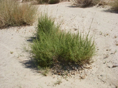
Scientific Name: Funastrum utahense (Engelm.) Liede & Meve |
||
|
Common Name: Utah vine milkweed |
||
| Family: | Apocynaceae | |
| Element Code: | PDASC050M0 | |
| USDA Plants Symbol: | ||
|
Synonyms/Other Names: |
||
| CA Rare Plant Rank: | 4.2 |
| Fed List: | None |
| State List: | None |
| Global Rank: | G4 |
|
State Rank: |
S4 |
| Other Status: | |
|
CRPR Changes: changed from 4.3 to 4.2 on 2009-03-10 |
|
| Add Date: | 1980-01-01 |
| Date Edited: | 2022-01-05 |
| Lifeform: perennial herb | ||||||||||||||
Blooming Period: (Mar)Apr-Jun(Sep-Oct)
|
||||||||||||||
|
Elevation:
100 - 1435 meters 330 - 4710 feet |
||||||||||||||
General Habitats:
|
||||||||||||||
| Microhabitat Details: | ||||||||||||||
Microhabitat:
|
||||||||||||||
| Threat List Total: | 0 | |
| Total EOs | % of EOs | |
| EOs with Threat Listed: | 0 | 0 % |
| THREAT LIST: | ||
|---|---|---|
| Total Occurrences: | 0 | ||||
| Element Occurrence Ranks: | |||||
|---|---|---|---|---|---|
| A | B | C | D | X | U |
| 0 | 0 | 0 | 0 | 0 | 0 |
| Occurrence Status: | |||||
|---|---|---|---|---|---|
| Historical >20 Years | 0 | ||||
| Recent <=20 Years | 0 | ||||
| Presence: | |||||
|---|---|---|---|---|---|
| Presumed Extant | 0 | ||||
| Possibly Extirpated | 0 | ||||
| Presumed Extirpated | 0 | ||||
| California Endemic: | |||||||||||||
| California Island: | |||||||||||||
|
States: Name (Code) Arizona (AZ), California (CA), Nevada (NV), Utah (UT) |
|||||||||||||
|
California Counties and Islands: Name (Code) Imperial (IMP), Inyo (INY), Riverside (RIV), San Bernardino (SBD), San Diego (SDG) |
|||||||||||||
|
Quads: Name (Quad Code) Arica Mountains (3411418), Ash Hill (3411661), Big Bear City (3411637), Big Maria Mts. NW (3311486), Bighorn Canyon (3411635), Bitter Spring (3511624), Blind Hills (3411573), Bristol Lake SW (3411536), Carrizo Mtn. (3211671), Chuckwalla Spring (3311542), Clarks Pass (3411515), Coyote Wells (3211568), Daggett (3411678), Dale Lake (3411526), Deadman Lake SE (3411631), Deadman Lake SW (3411632), Desert Center (3311564), Earthquake Valley (3311614), Emerson Lake (3411644), Fenner Hills (3411582), Goat Mountain (3411633), Goffs (3411581), Havasu Lake (3411444), Hayfield (3311566), Hector (3411674), Hidalgo Mtn. (3411643), Indian Cove (3411612), In-ko-pah Gorge (3211661), Ivanpah Lake (3511554), Joshua (3511534), Joshua Tree North (3411623), Landers (3411634), Lavic Lake (3411663), Lead Mountain SW (3411538), Ludlow SE (3411651), McCoy Peak (3311467), McCoy Wash (3311466), Melville Lake (3411645), Morgans Well (3411652), Needles (3411475), Needles SW (3411476), Nipton (3511543), Old Woman Springs (3411646), Painted Gorge (3211578), Pinto Mountain (3311587), Plaster City (3211577), Ranchita (3311625), Rattlesnake Canyon (3411636), Roosevelt Mine (3311457), Sidewinder Well (3311562), Silver Bell Mine (3411665), Sleeping Beauty (3411673), Stump Spring, Nev. (3511587), Sunfair (3411622), Sunshine Peak (3411664), Sweeney Pass (3211672), Thumb Peak (3311447), Troy Lake (3411675), Twentynine Palms (3411621), Valley Mtn. (3411528), Victory Pass (3311574), West of Soda Lake (3511622) |
|||||||||||||
Notes:
|
|||||||||||||
 Presumed Extant
Click on quad for name. Hold Shift Key to use mouse scroll wheel